
|
ABOUT THE ECUADOR FOREST OF CLOUDS PROJECT AREA
The project area is located close to the town of Mindo, in the province of Pichincha, in the Metropolitain District of Quito, along the northwestern mountain ranges of the Andes Ecuadorians in Ecuador. The entire project area comprises approximately 700 hectares of biologically diverse Montane Cloud Forest. Forests of this region are important nationally and internationally for the ecosystem services that they provide. The project area is located within the northwestern mountains of the Ecuadorian Andes, where two of the greatest areas of biodiversity in the ecological region unite; The Choco-Darien and the Tropical Andes. This transitional area covers approximately 268 square kilometers (103 sq mi) with an average altitude of 1400 - 2500 meters above the sea level. Three large rivers (Mindo, Saloya and Cinto) and hundreds of streams irrigate the land in the area, which is mostly covered in Primary Forests with very few settlements. In general these forests, have experienced a continuous reduction of their biomass due mostly to illegal timber extraction and logging via these rivers. Illegal timber extraction is historically an important source of income within the project zone and the surrounding areas. Following from the gradual degradation of forests caused by continual timber extraction, many forest areas are ultimately converted to agriculture and pasture to generate income for local communities. The project aims to alleviate these pressures on the forests through the support of a governance capacity (including property titling, land-use planning and conservation zone demarcation) and the generation of alternative economic activities and income sources for the local community. The activities of the project, in addition to protecting the local forests and biodiversity, will contribute to the social and economic development of one of the poorest areas of the Ecuador. The land around the Mindo area is extremely valuable, to potential famers, loggers, miners, and other conservation/ecological projects. The growing size of the capital city Quito means that additional agricultural land is needed to produce enough sustainable food to supply the city. Unfortunately this means converting forest lands into agricultural and pastoral land. It is clear to see on satellite maps of the locality the encroaching areas of farmland slowly creeping through the valleys of the rainforests, creating forests of a mosaic nature and isolating endemic breeding groups. |
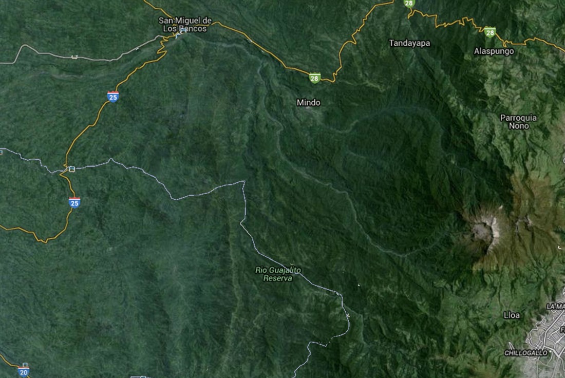
Above: General Location of the Project Zone
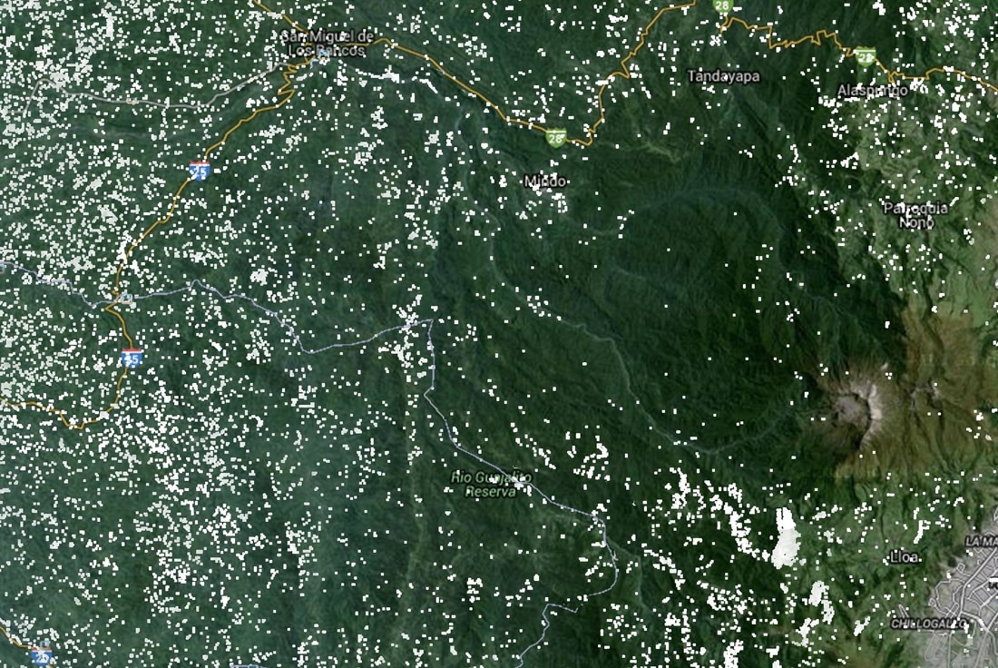
Above: Image depicting the deforestation and or degradation of the forests in the project area within the last 14 years (white areas).
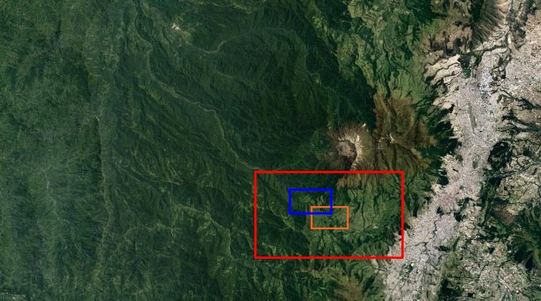
Above: General overview of the project location in relation to the enhanced images below, Figure 1 (red), Figure 2 (orange) and Figure 3 (blue).
It's clear to see the decimation of the forests caused by logging and conversion of forests to farmland, encroaching extremely close to the project zone. It's only a matter of time before illegal deforestation on this scale takes place within the project zone. |
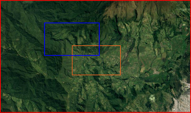
Figure 1 above: Enhanced image of the Red location on the previous image. In the bottom right corner is the encroaching city of Quito. To the top left corner is the land adjacent to the project zone.
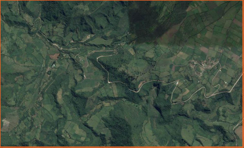
Figure 2 above: Enhanced image of the Orange location on Figure 1. Areas of deforestation and conversion to cropland are clearly visible.
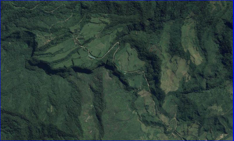
Figure 3 above: Enhanced image of the Blue location on Figure 1. This area is extremely close to the project zone. You can clearly see the deforestation taking place radiating away from the stream. The stream gives access through the thick forest and a means of transporting the felled trees. This stream continues northwards into the project zone.